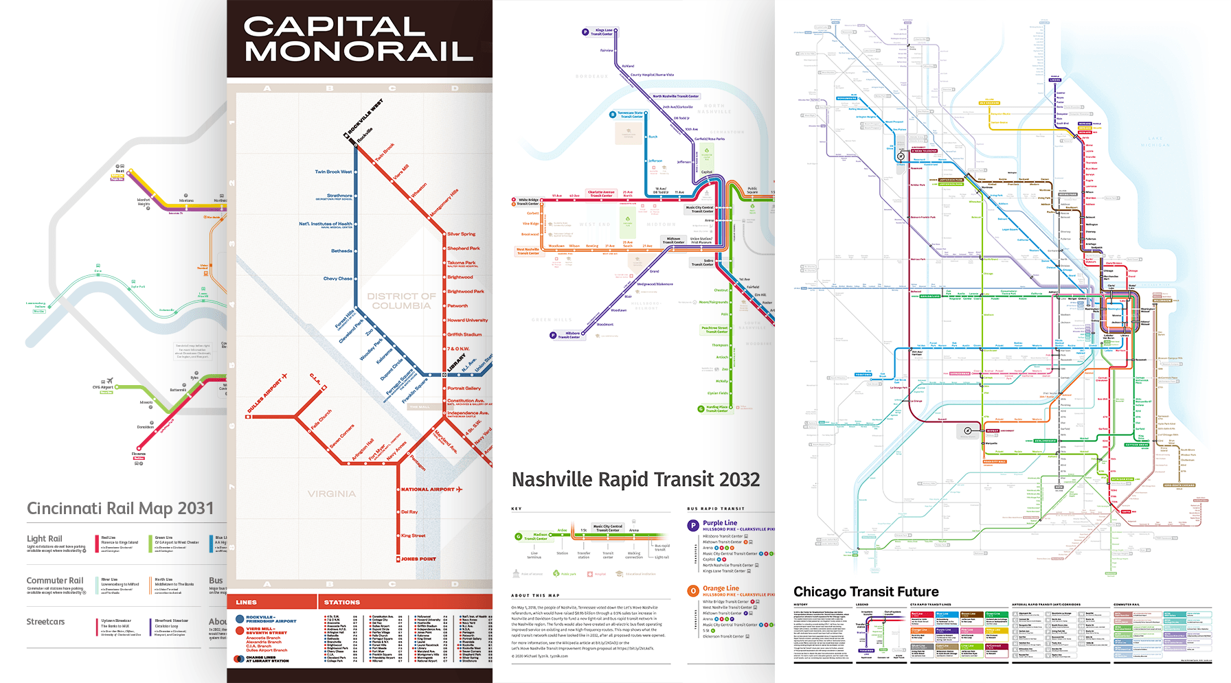
Past future transit maps
Past future transit maps
This series of transit maps shows various proposed transit systems or expansions that never fully came to be.
Jump to: Chicago | Nashville | DC Monorail | Cincinnati
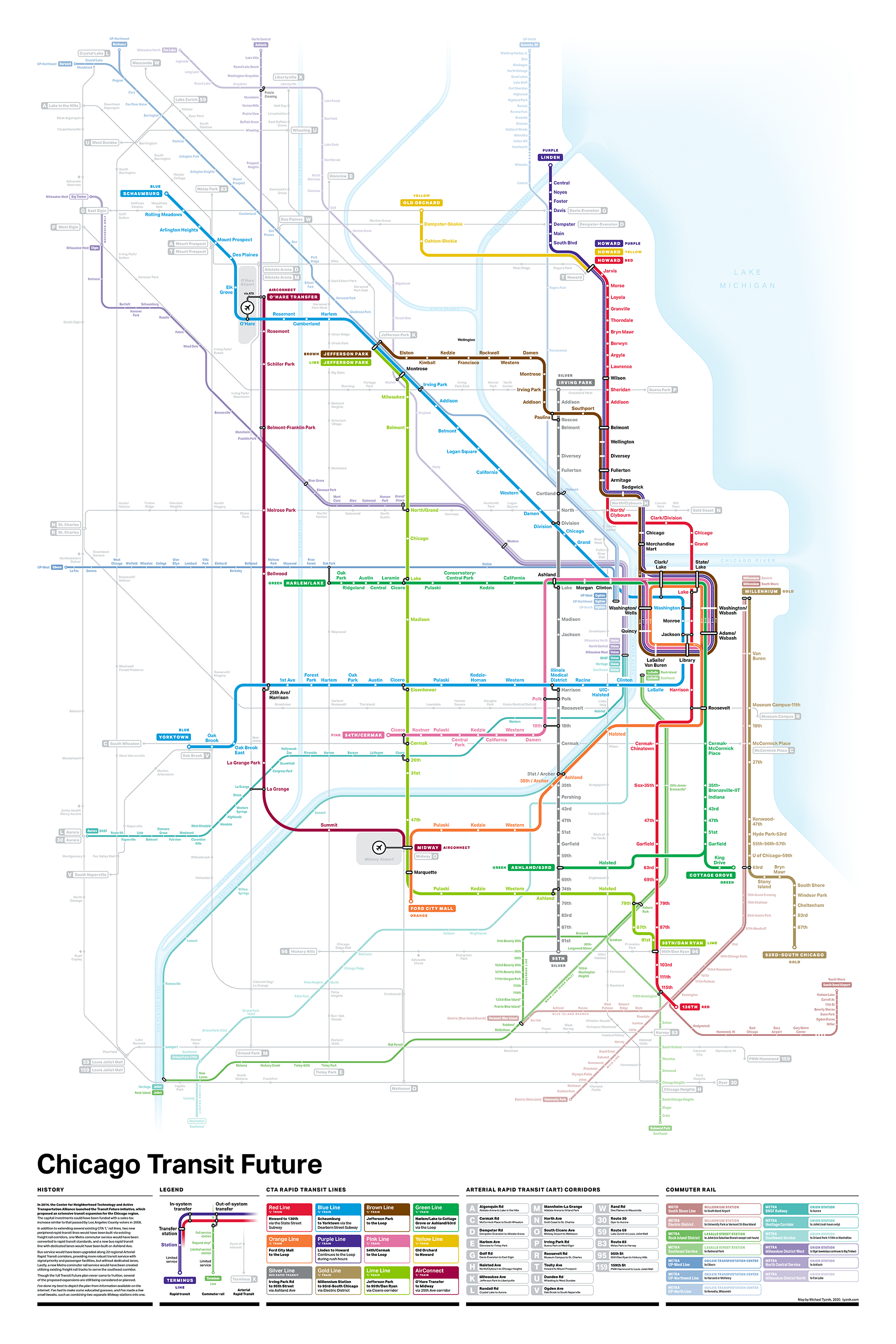
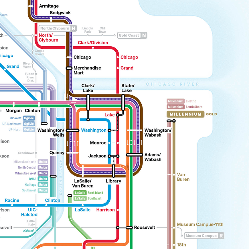
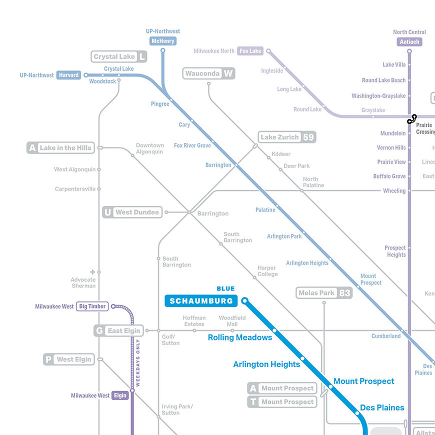
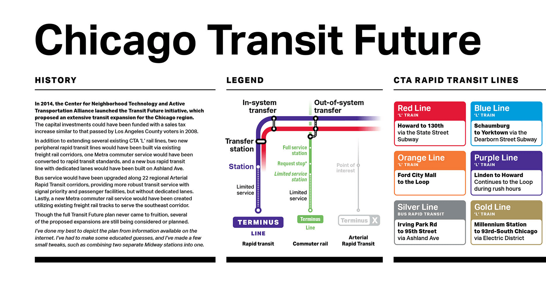
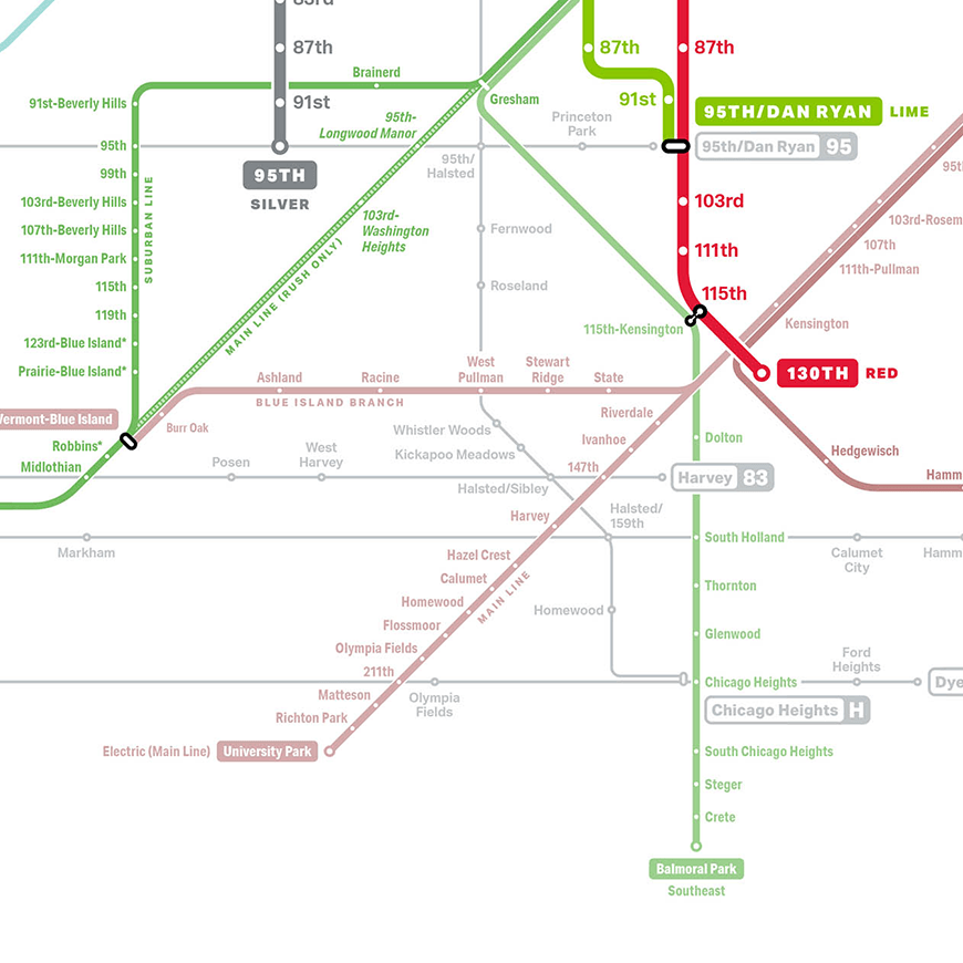
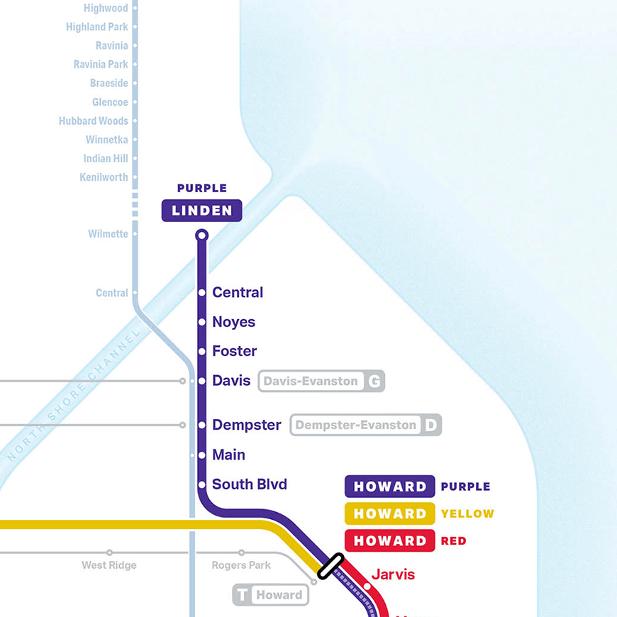
Chicago Transit Future
Chicago Transit Future
Chicago Transit Future
In 2014, the Center for Neighborhood Technology and Active Transportation Alliance launched the Transit Future initiative, which proposed an extensive transit expansion for the Chicago region. The capital investments could have been funded with a sales tax increase similar to that passed by Los Angeles County voters in 2008.
In addition to extending several existing CTA ‘L’ rail lines, two new peripheral rapid transit lines would have been built via existing freight rail corridors, one Metra commuter service would have been converted to rapid transit standards, and a new bus rapid transit line with dedicated lanes would have been built on Ashland Ave.
Bus service would have been upgraded along 22 regional Arterial Rapid Transit corridors, providing more robust transit service with signal priority and passenger facilities, but without dedicated lanes. Lastly, a new Metra commuter rail service would have been created utilizing existing freight rail tracks to serve the southeast corridor.
Though the full Transit Future plan never came to fruition, several of the proposed expansions are still being considered or planned.
I’ve done my best to depict the plan from information available on the internet. I’ve had to make some educated guesses, and I’ve made a few small tweaks, such as combining two separate Midway stations into one.
Prints are available through Etsy, and a high-res map can be viewed here.
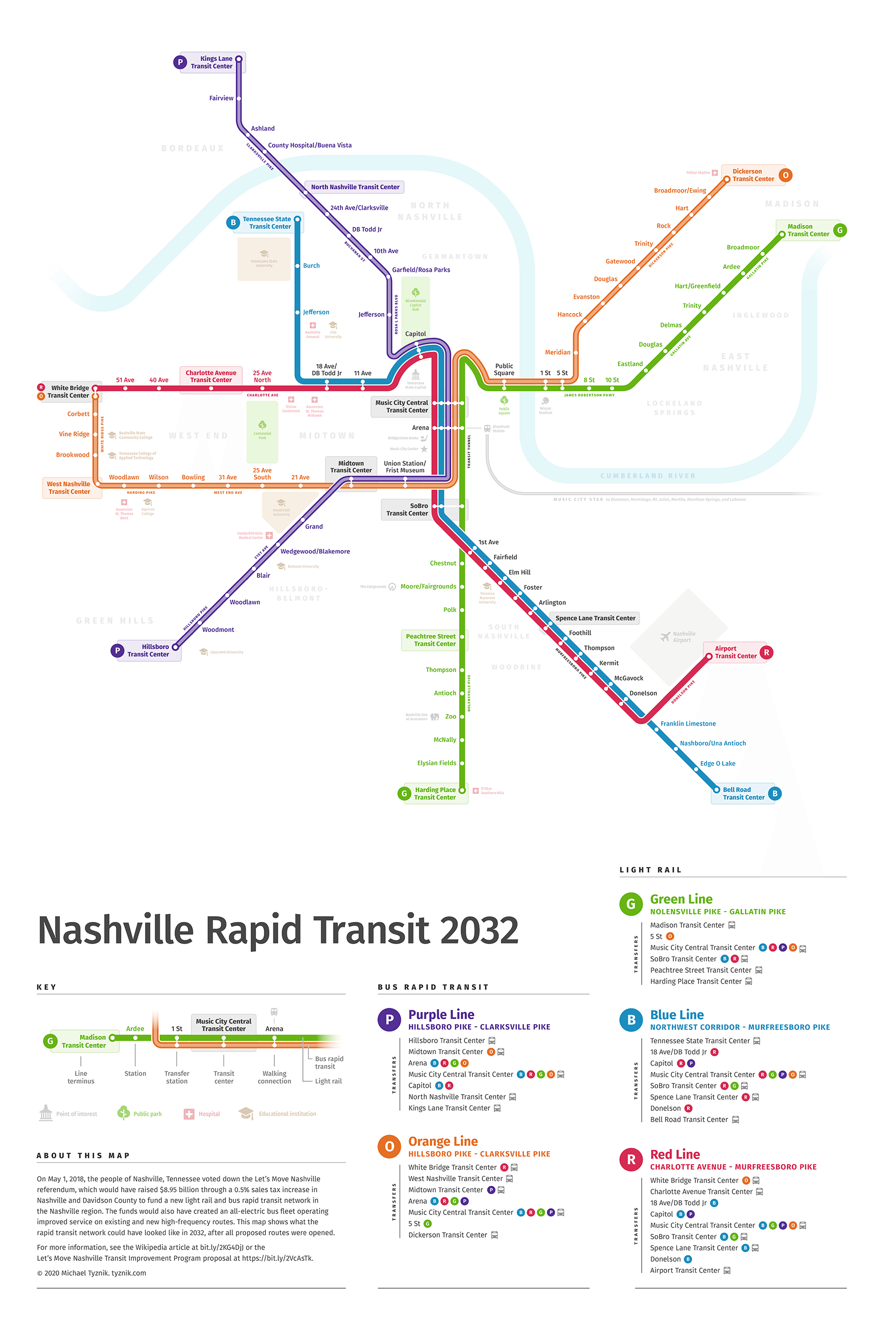
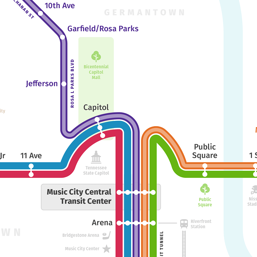
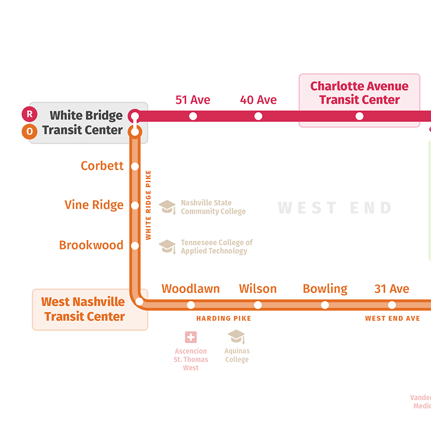
Nashville Rapid Transit 2032
On May 1, 2018, the people of Nashville, Tennessee voted down the Let’s Move Nashville referendum, which would have raised $8.95 billion through a 0.5% sales tax increase in Nashville and Davidson County to fund a new light rail and bus rapid transit network in the Nashville region. The funds would also have created an all-electric bus fleet operating improved service on existing and new high-frequency routes. This map shows what the rapid transit network could have looked like in 2032, after all proposed routes were opened.
Prints are available through INPRNT.
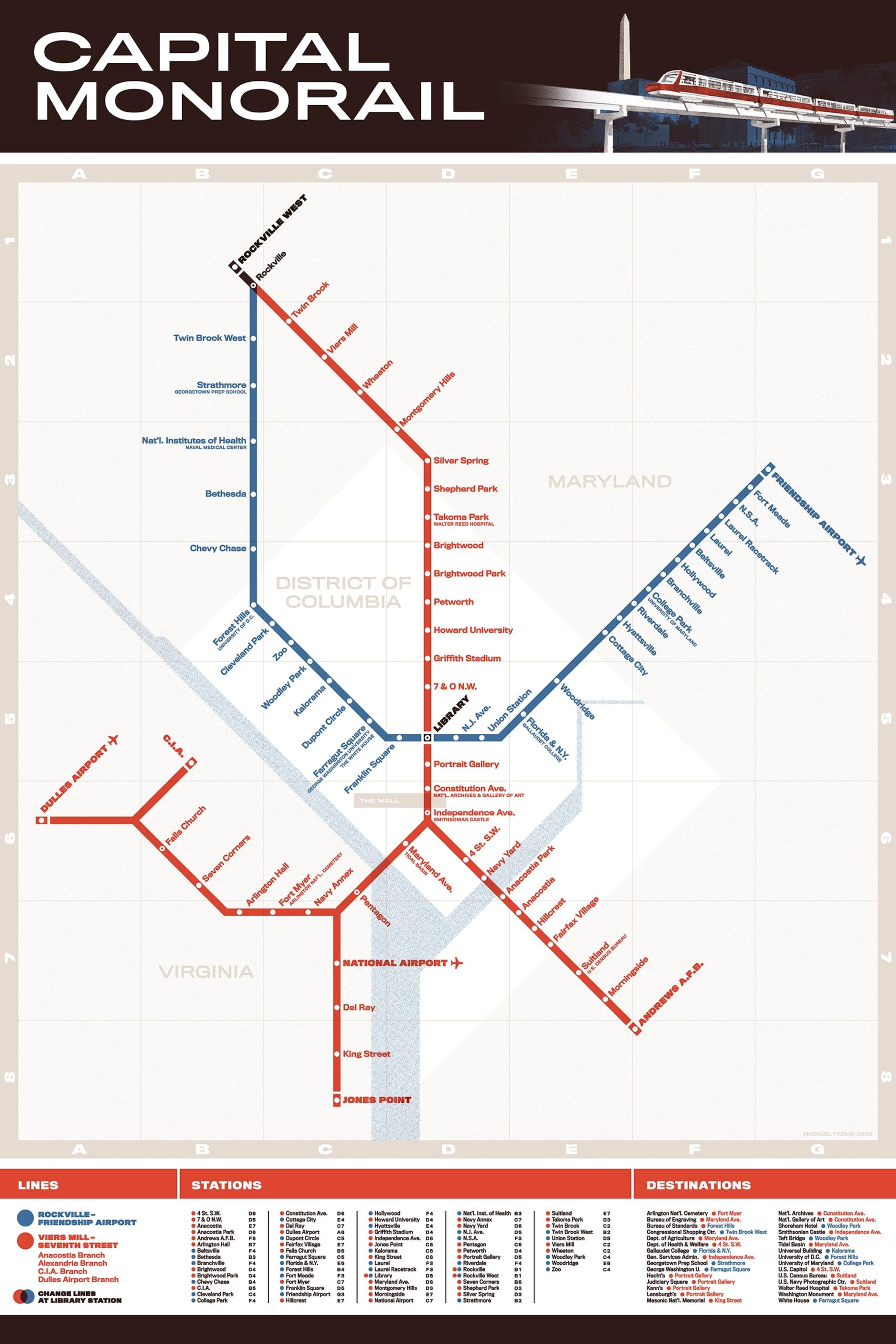
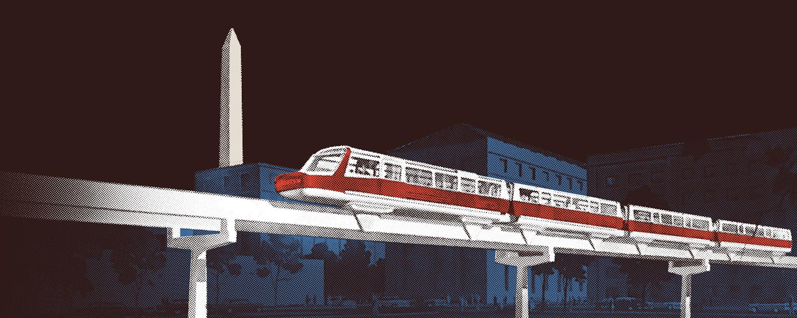
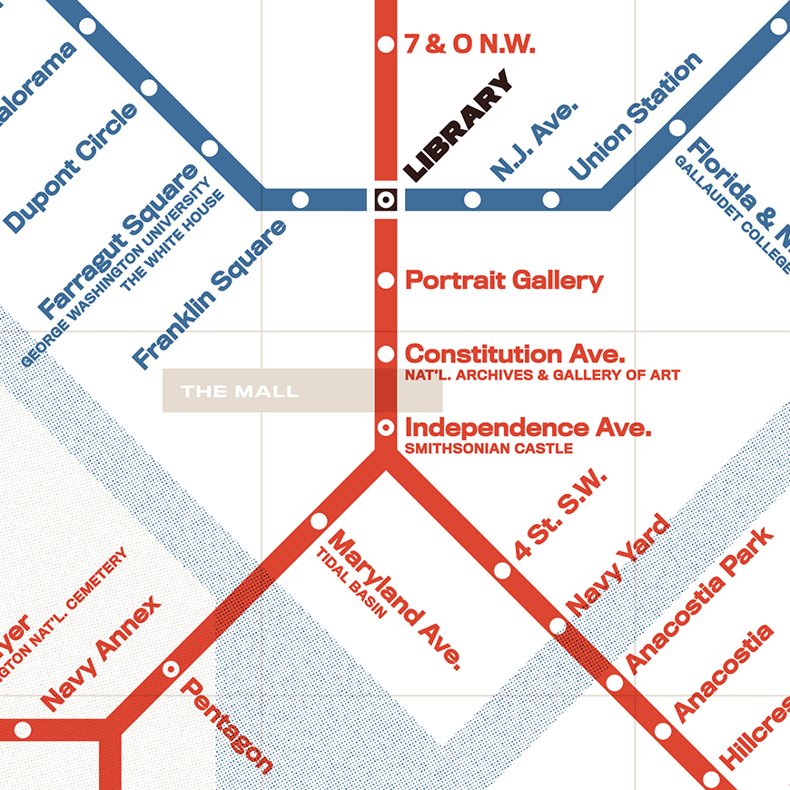
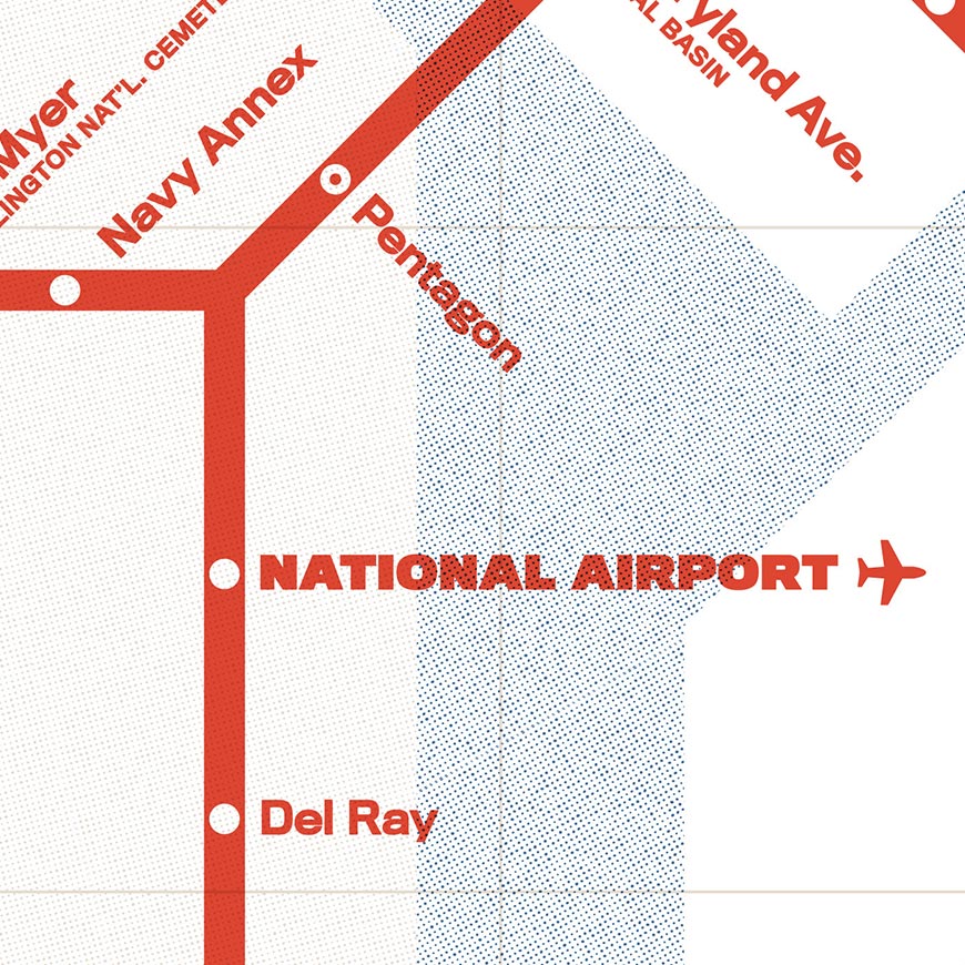
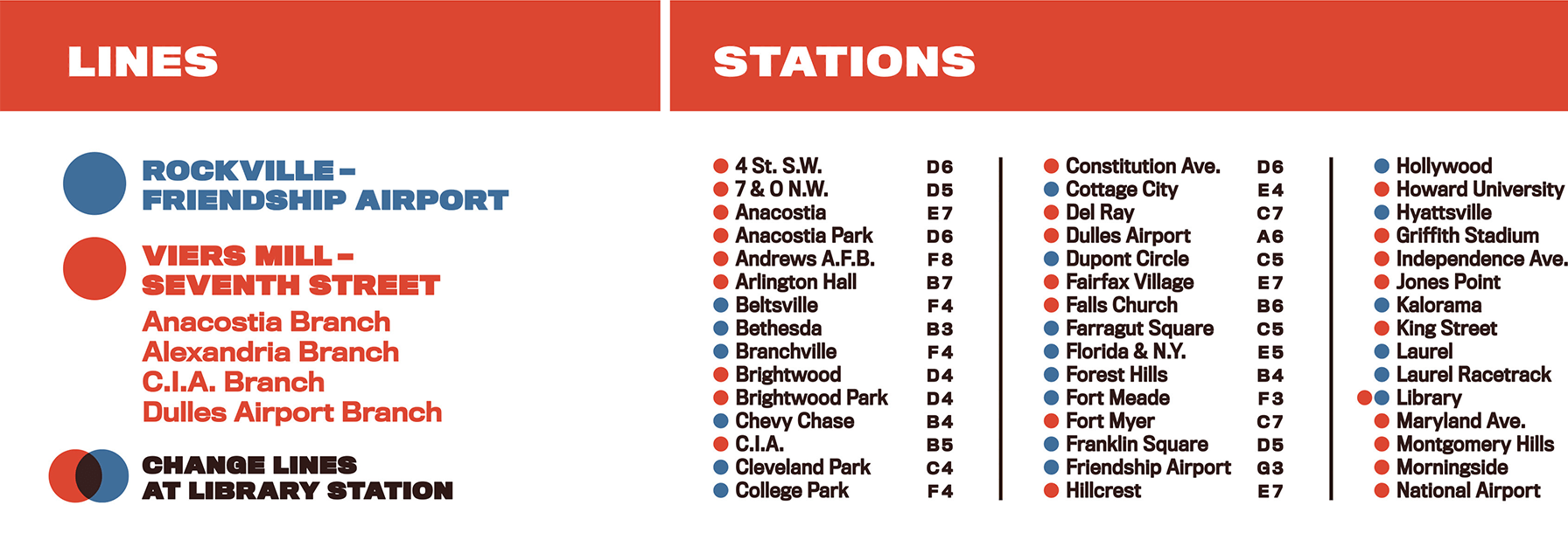
Capital Monorail
In 1959, O. Roy Chalk proposed an extensive monorail system for the Washington, DC capital region. The system would have had two lines, which would intersect in downtown DC near the Carnegie Library (now an Apple Store). This map shows my best guess as to how the system would have looked upon completion in the late 1960s. The illustration of the monorail itself is sourced from the original proposal.
The original proposal was read into the record of the US Congress.
Poster prints are available through Etsy.
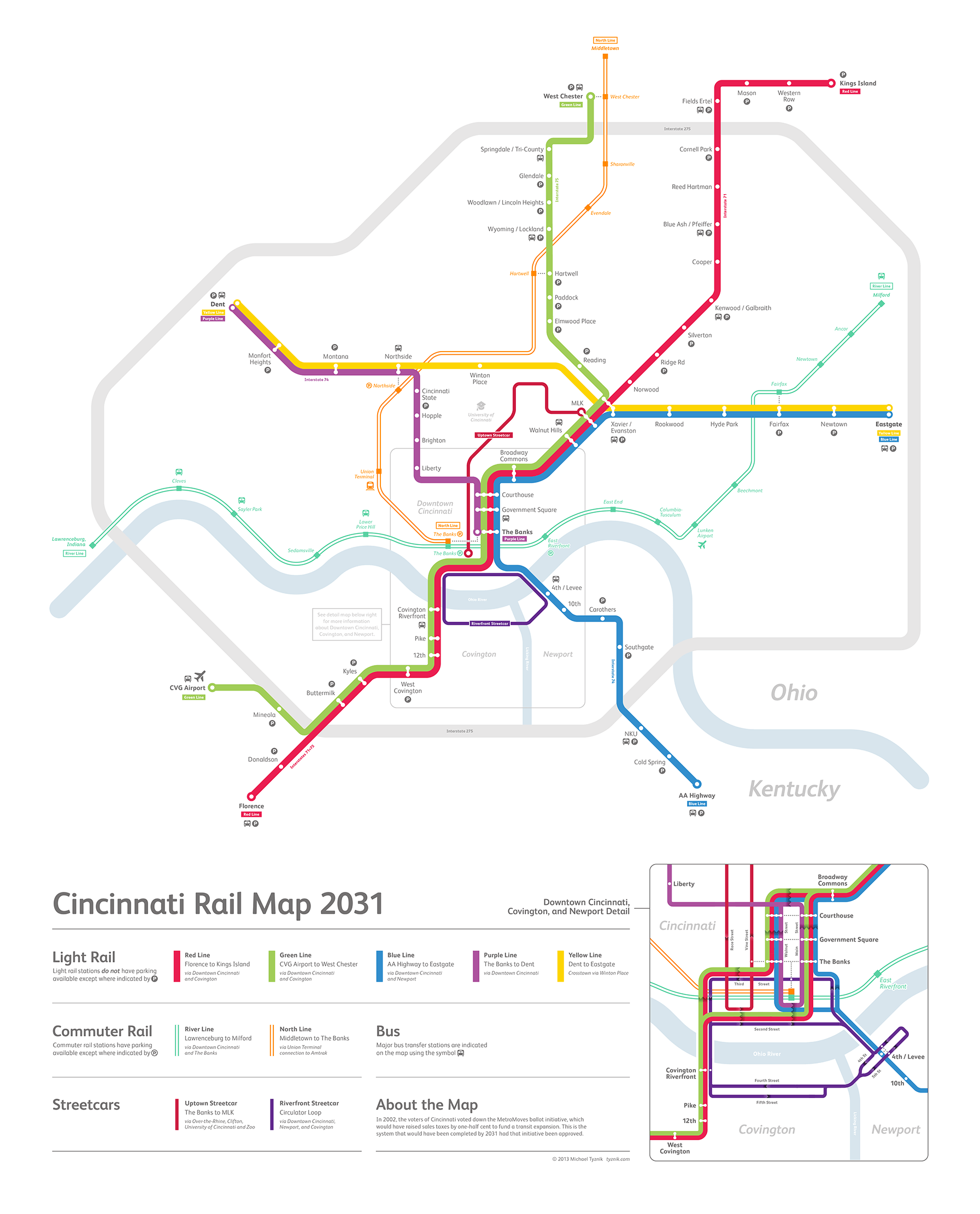
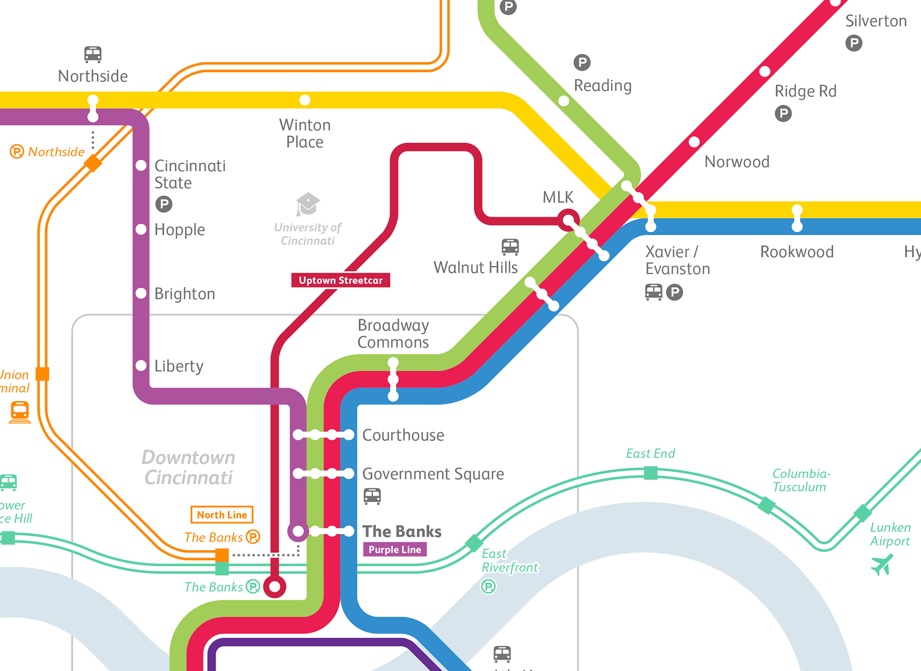
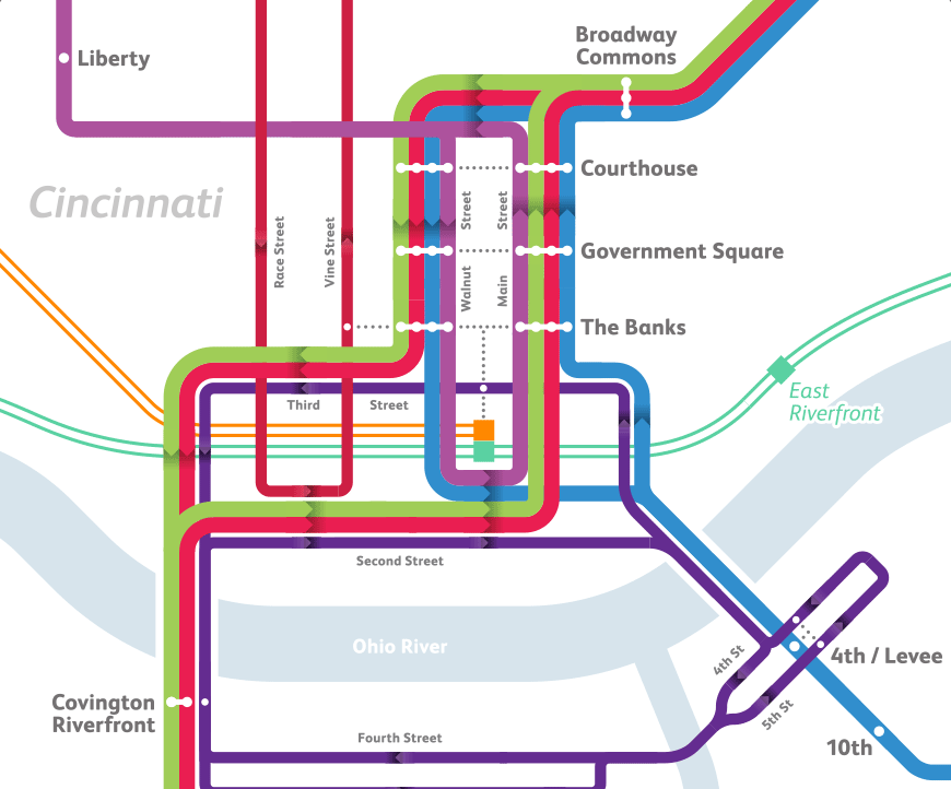
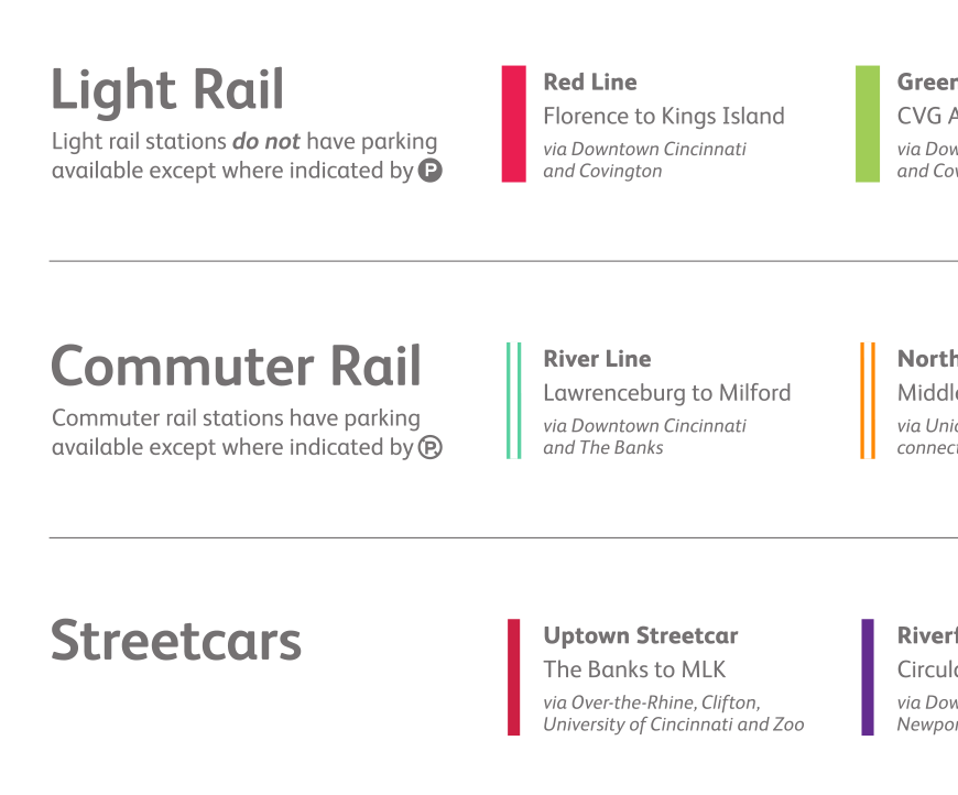
Cincinnati Rail Map 2031
In 2002, the voters of Cincinnati voted down the MetroMoves ballot initiative, which would have raised sales taxes by one-half cent to fund a transit expansion. This is the system that would have been completed by 2031 had that initiative been approved.
A high-quality poster of the map is available from Etsy. A PDF can be downloaded here.
← Back to work | © 2022 Michael Tyznik