
Game of Thrones transit maps
Past future transit maps

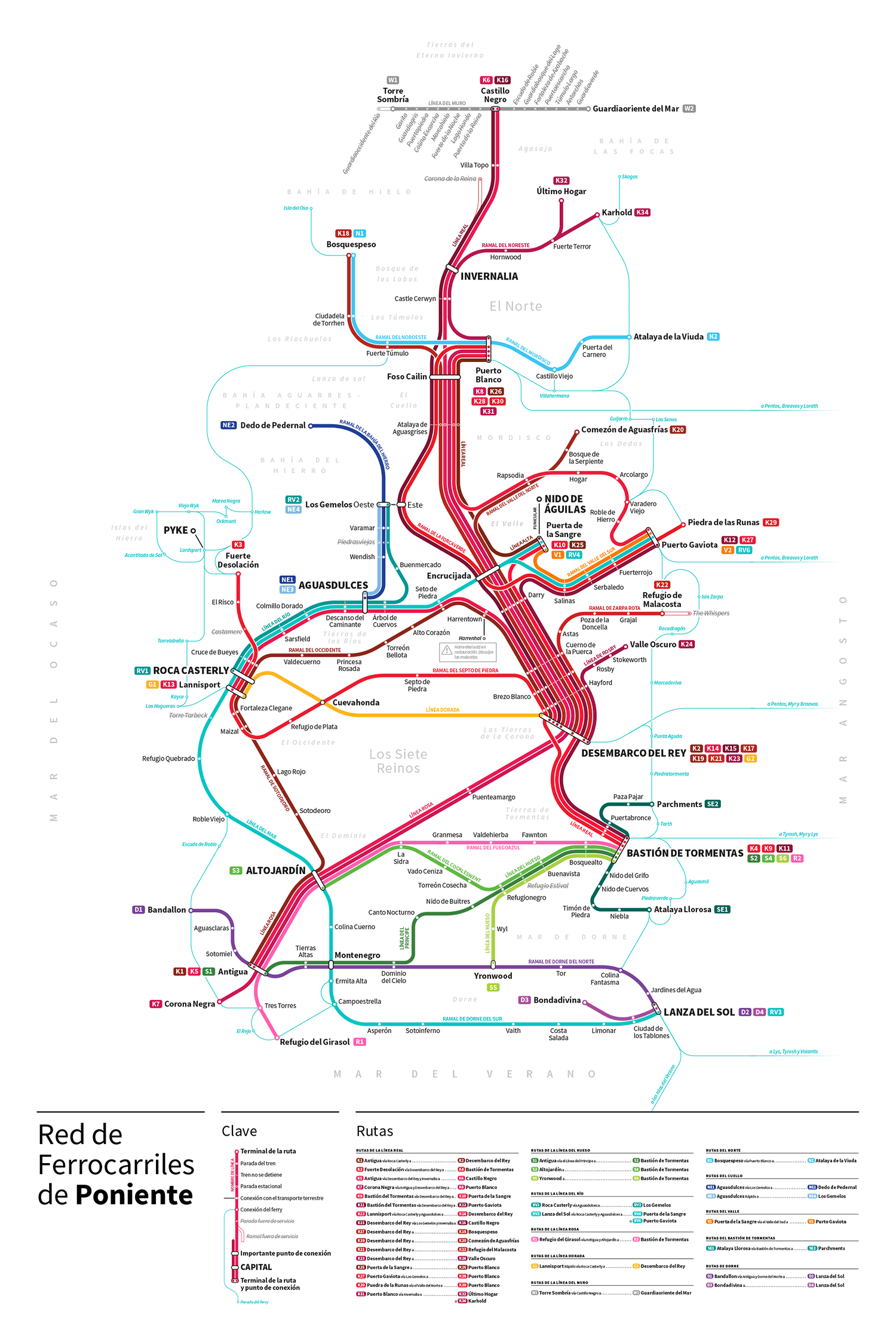
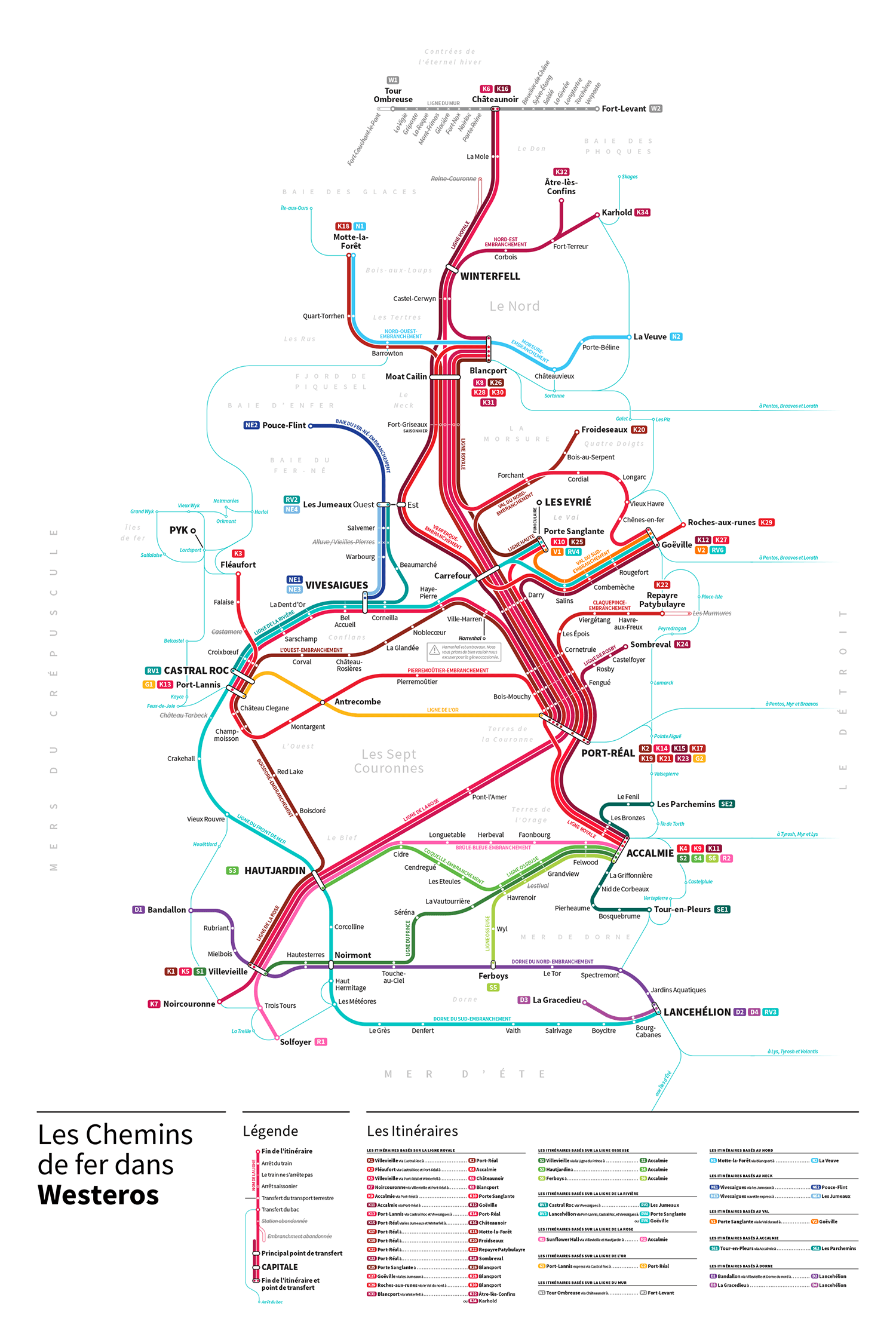
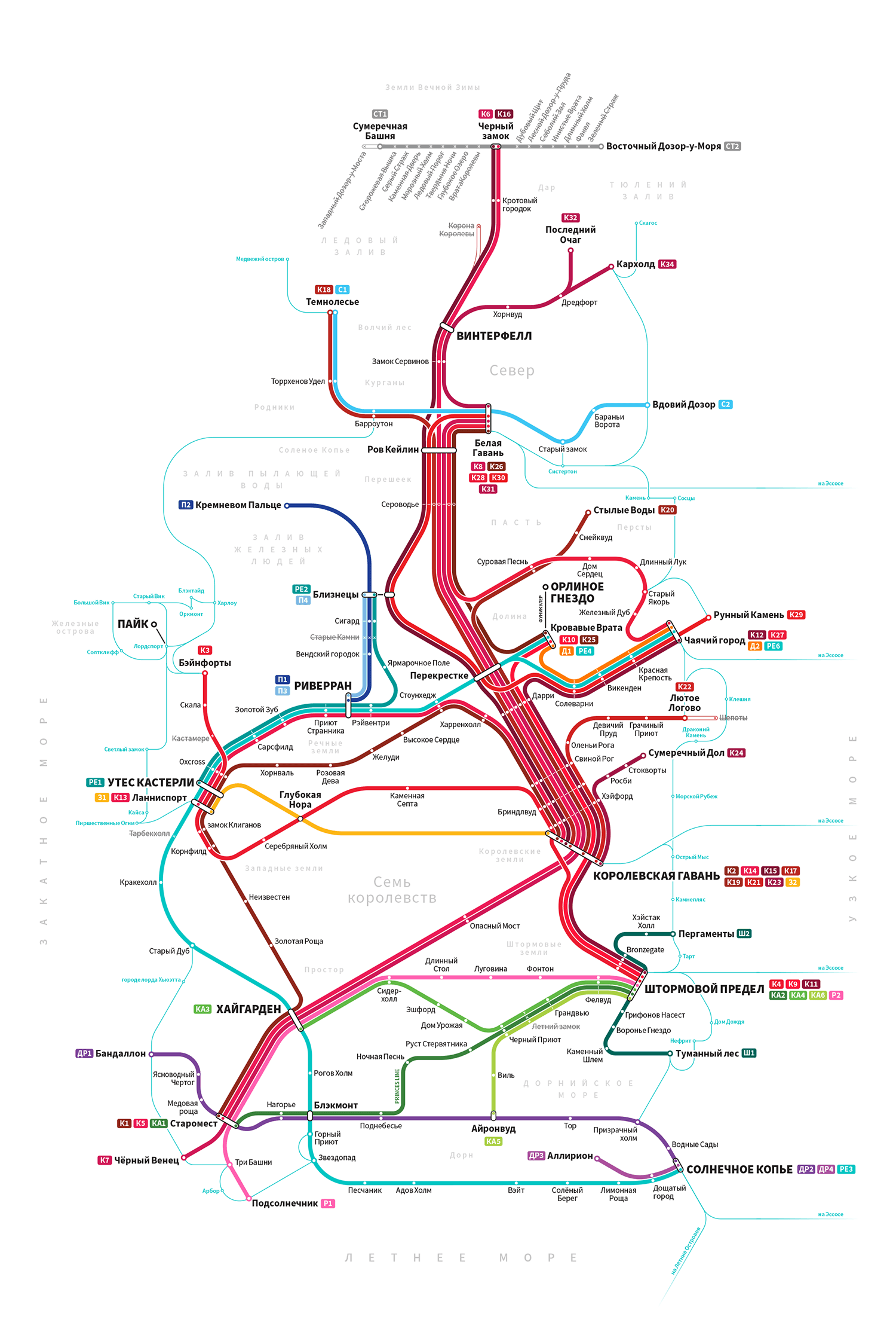
Inspired by the work of Cameron Booth and his awesome Transit Maps Blog, I created these rail maps of Westeros and The Known World. Hopefully fans will notice some small touches — the closed stations along the Wall Line, for example.
Prints of the maps are available on Etsy. You can also view the maps at high resolution on my Flickr: Westeros and The Known World.
Featured by The Verge, The Escapist, The Guardian, Mashable, Boy Genius Report, Polygon, Buzzfeed, Fast Company, Cnet, Kotaku, MTV, The Washington Post, Jezebel, Gizmodo, Le Monde de Vanity Fair, The Daily Record, and the Transit Maps Tumblr. Shortlisted for the 2014 Information Is Beautiful Awards.


International versions
Thanks to the strong international fanbases of Game of Thrones, I was able to use wikis in other languages to find translations of place names and create maps in French, Spanish, Russian, and Mandarin.
← Back to work | © 2024 Michael Tyznik