
Elder Scrolls Transit Map
Past future transit maps
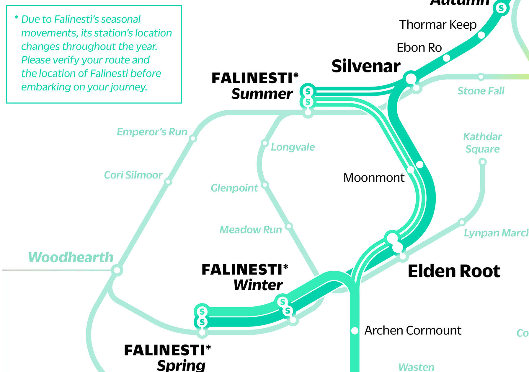
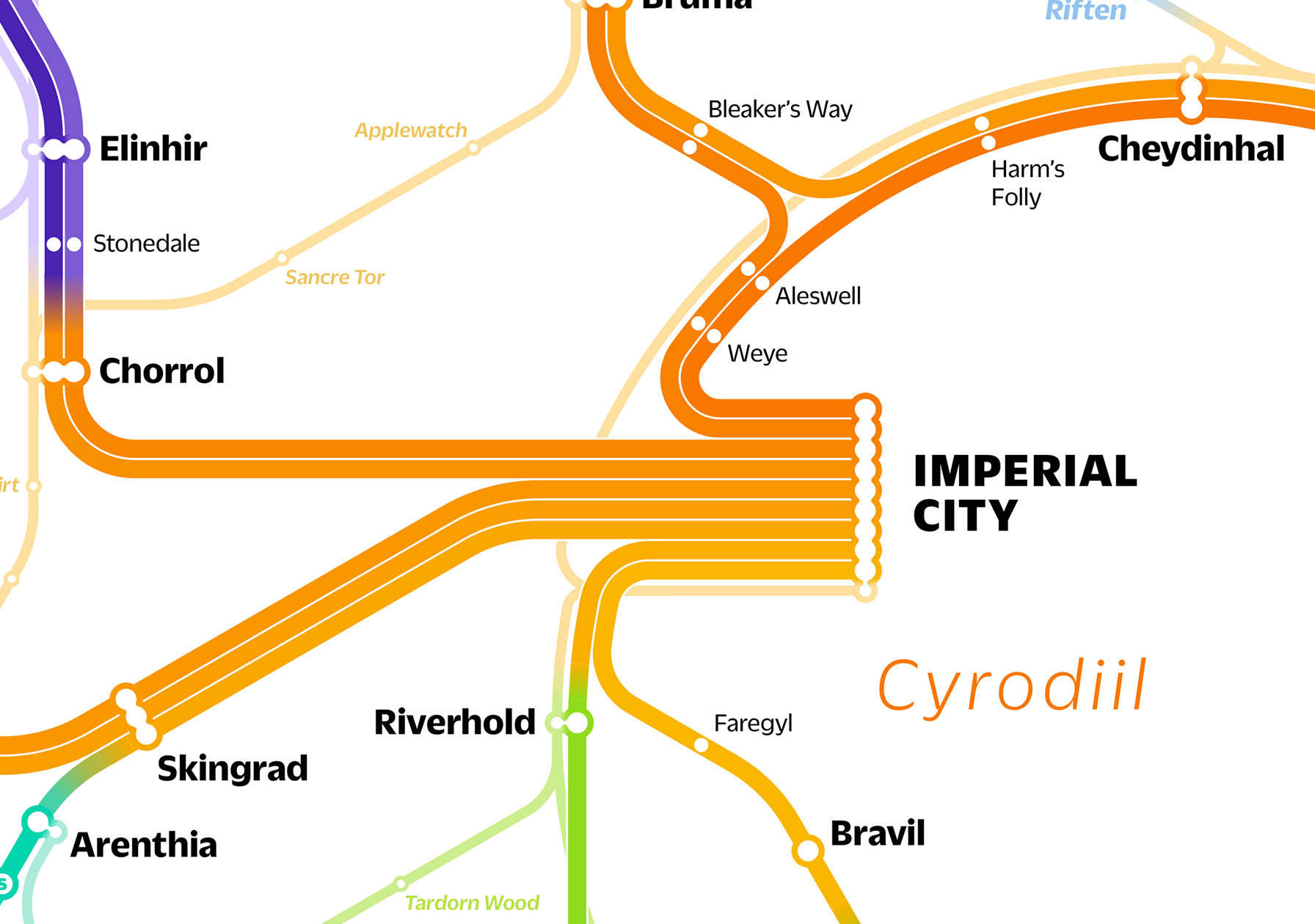
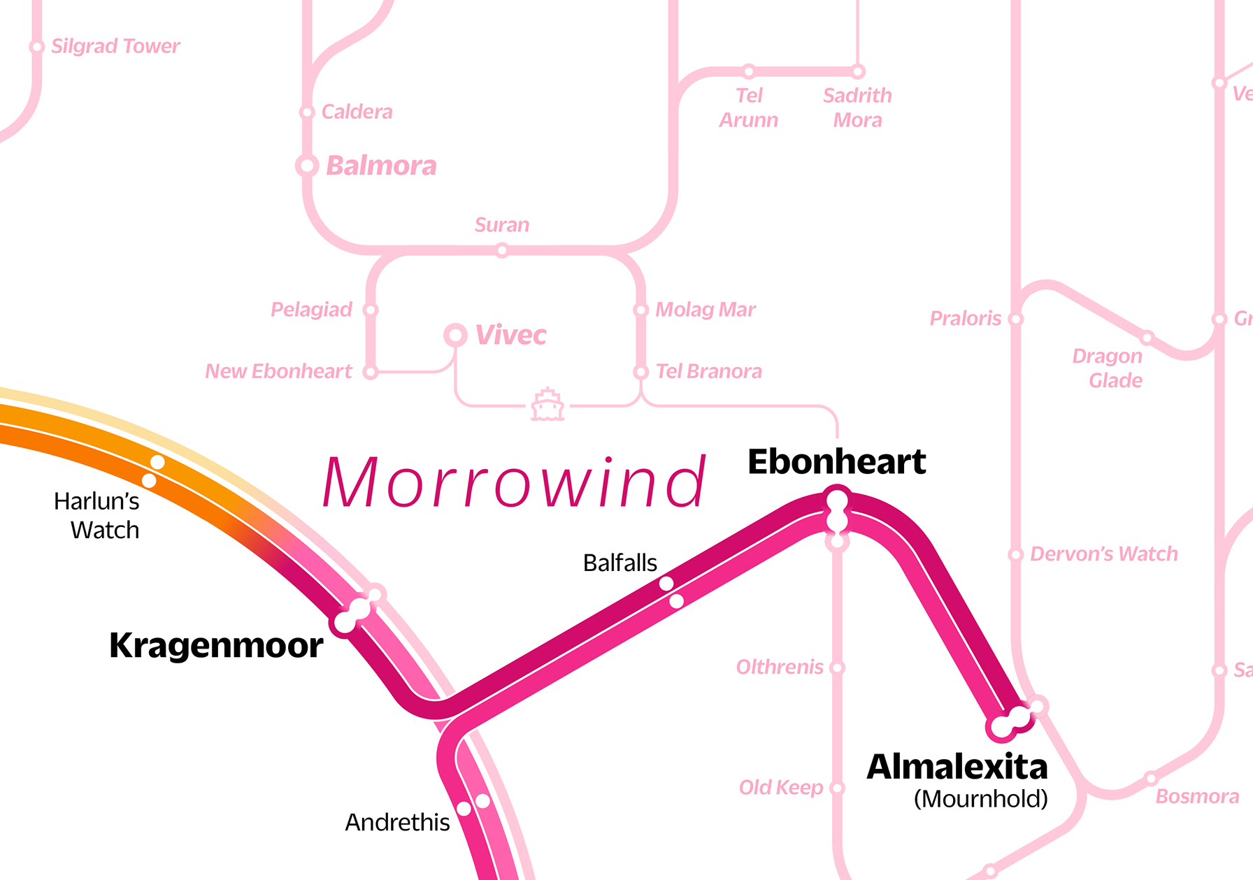
Following up on my Game of Thrones transit maps, I created this railway map of Tamriel, the setting for the Elder Scrolls series of video games. As many of the games have focused on a single province of Tamriel, e.g. III: Morrowind, IV: Oblivion (Cyrodiil), and V: Skyrim, I wanted to highlight these provinces in the design of the map. Rather than adding a geographic overlay, I used the color of the routes themselves to show the provinces.
Prints of the maps are available on Etsy.
Thanks to Arthmodeus, Prometheus, UESP, The Elder Scrolls Wiki for the information that made this map possible.
Info on the making of this map is available here.


Making the map
Past future transit maps
Here's a quick walkthrough on how I made this map.

Luckily, the Elder Scrolls series and Game of Thrones have extremely dedicated fan communities who have put long hours into mapping the geography of their worlds. This map of Tamriel by Arthmodeus and Prometheus was one of my main reference points in creating my map.

First, I found the most important cities that I know I would want to include on the map, and which would be main stops.

Next, I tried to connect those cities with train lines in logical ways. In the process, I attempted to make routes that crosed through as many small towns as possible.

I then called out which among the routes I'd created would be the most important.

Then I started to fill in as many small towns along the lines as possible.

Now it's time to convert from a geographic map to a diagrammatic one. I noticed this circle formed by lines around the Imperial City, and thought a loop line here would make a good focal point for the map. These are the guides I used to create the loop.


I then had to decide what angles I wanted to use in my map. Many transit maps use 45° and 90° angles, such as the classic London Tube map (left).
I decided to use 30°, 60°, and 90° angles, like this map of Amsterdam (right). The extra angles allow for more flexibility in composing the map.
Starting from the ring line, I began to lay out the main train lines.

Next, I started to fill in the stops along the main lines.

I also added secondary lines connecting minor cities to add more detail to the map.

As the map got more complicated, I added random colors to the lines to help me keep them apart.

I then decided I wanted to show the provinces on the map, but without adding extra complication with another layer or more lines. Instead, I used the colors of the lines themselves.

And finally, the finished map.

← Back to work | © 2024 Michael Tyznik